GeoAI and Neuro-Symbolic AI for the Environment and Architectural Heritage (Matrone, PoliTo)
 Francesca Matrone giving the talk
Abstract
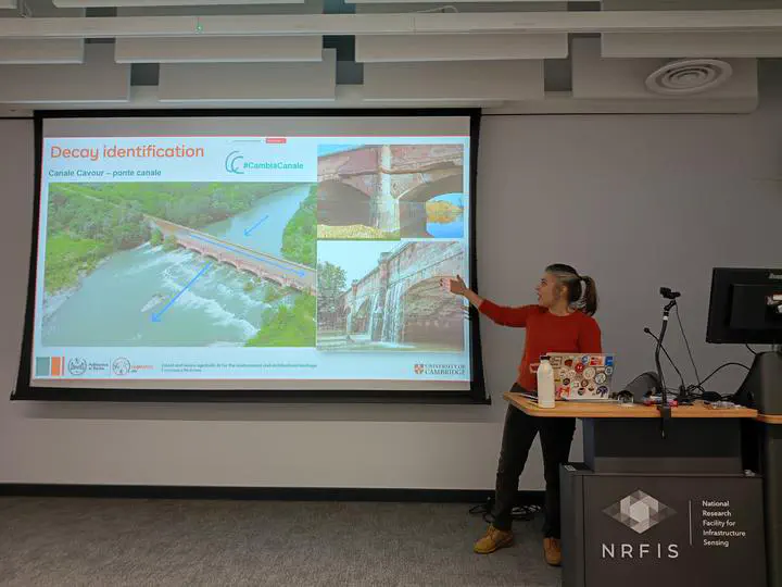
The talk presents GeoAI approaches for environmental monitoring and architectural heritage analysis using multi-scale, multi-sensor data (satellite, UAV multispectral/hyperspectral imagery, LiDAR, and MMS point clouds). Applications include decay detection, vegetation classification, climate change assessment, underwater 3D reconstruction, and scan-to-HBIM. A special focus will be on semantic segmentation of heritage point clouds, introducing Logic Tensor Networks to integrate domain knowledge into data-driven models, improving consistency and accuracy.
Francesca Matrone is an Assistant Professor in the Geomatics Laboratory at the Department of Environment, Land and Infrastructure Engineering (DIATI), Politecnico di Torino, Italy. Her research focuses on deep learning for geospatial data, particularly scene understanding and semantic labelling. She works across scales from urban environments to object, including 3D city modelling, scan-to-BIM, and point cloud registration. During her PhD, she was a visiting researcher at MIT CSAIL (Boston) and INSA Strasbourg. She is Secretary of ISPRS Working Group II/2 – Point Cloud Generation and Processing and co-organized ECCV24 AI4DH workshops on Artificial Intelligence for Digital Humanities.
Feel free to reach out to explore potential collaborations! Stay tuned for more from the CV4DT and CAMCV!